Performing Spatial Joins
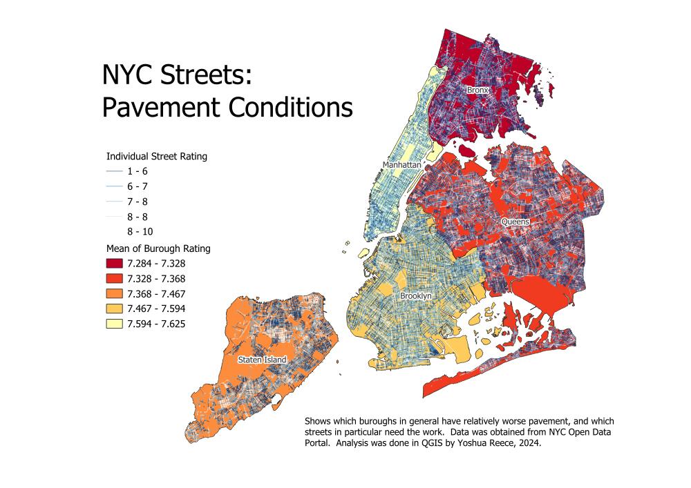
For this project I first followed a tutorial, then added to it by visualizing the result in a different way. The tutorial involved using the spatial join with summary algorithm to join the average street rating to each borough. I decided to use graduated symbology by the value of the pavement rating for both the boroughs and the individual streets to make a more effective thematic map.
Tutorial: Performing Spatial Joins (QGIS3) — QGIS Tutorials and Tips
