Browsed by
Tag: spatial analysis

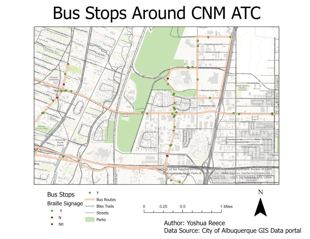
Bus Stops Around Campus

Bus Stops Around Campus

Description: This map is the product of a lab I did in my GIS 1 course taught by John Beltran at Central New Mexico Community College (CNM). It shows the distribution of bus stops around the Advanced Technology Center (ATC) campus of CNM.

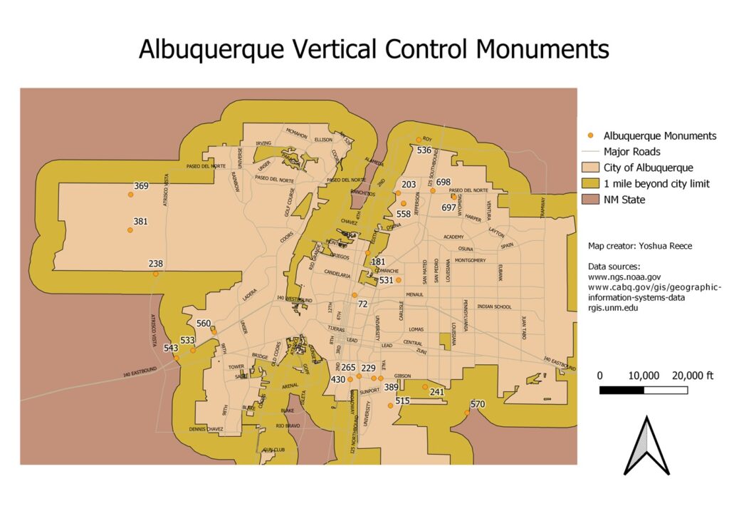
Albuquerque Vertical Control Monuments

Albuquerque Vertical Control Monuments

Description: Vertical control monuments, or survey markers, are markers placed in key points on the Earth’s surface, used in land surveying. The map was the product of a lab done in the course “Geospatial Technology” taught by the instructor John Beltran at Central New Mexico Community College. In the lab, I performed a basic spatial analysis using various data. Although the analysis is simple, I was performing quite a few tasks, including creating queries.