Yoshua F. Reece
  • Home
  • About me
  • Contact
Performing Table Joins

Performing Table Joins

August 14, 2024 yreece

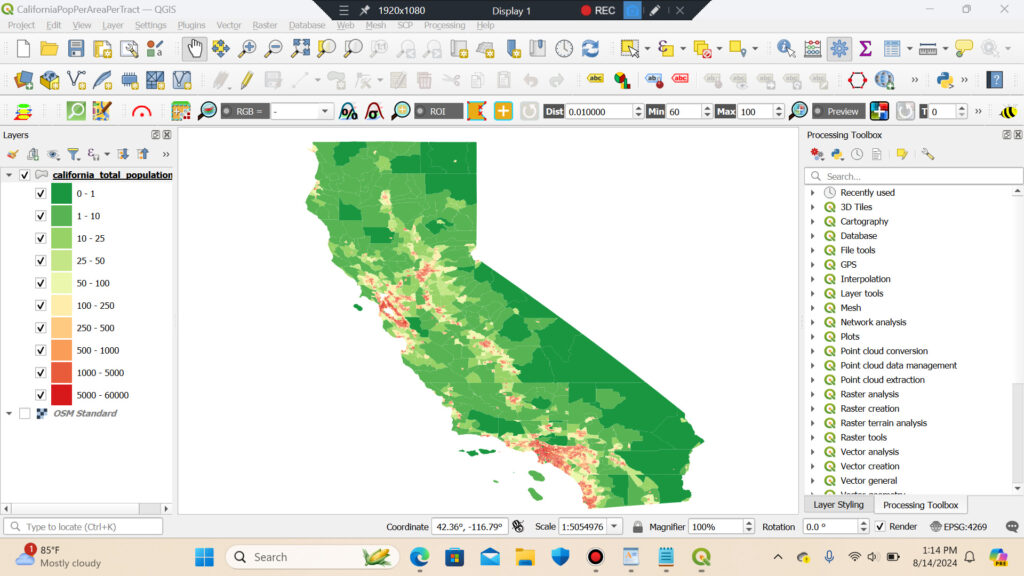
Description: Following a tutorial, I used a shapefile of census tracts for California and a population data table from US Census Bureau to create a population density map for California.

Tutorial: Performing Table Joins (QGIS3) — QGIS Tutorials and Tips


QGIS

Post navigation

PREVIOUS
Importing Spreadsheets or CSV files
NEXT
Rice Paddy Yield by Province in Vietnam (2020)
Comments are closed.
My someday cactus farm
  • Portfolio
  • PostgreSQL
  • Python
  • QGIS

agriculture agroforestry climate CodeCademy data visualization digitizing ecology elevation georeferencing Hydrology interpolation LULC multi-criteria analysis Network analysis OSM processing model Public health public safety raster analysis spatial analysis spatial joins SQL Time Data urban vector geometry web mapping

© 2025 | Proudly Powered by WordPress | Theme: Nisarg